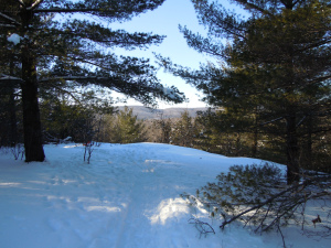
Called Indian Lookout in the 1940’s, this viewpoint off Musie Road is part of the trails land owned by the Municipality.
Chelsea is endowed with a rich network of informal trails that have been here since before the mid-1800s. Originally these were wagon trails or foot paths providing Chelsea’s rural residents with access to the Gatineau River and to the railway line that moved passengers and freight north and south. For example, the trail from Larrimac Golf Club to Meech Lake was originally called Cooper’s Trail. Known today as the Wood Trail, this route splits into three parts at O’Rourke’s clearing—one branch ending at Cowden Road, near Pine Road, in the Meech Creek Valley, another crossing Meech Creek at the ruins of Thomas “Carbide” Willson’s fertilizer mill, and a third emerging at what was the Dunlop Farm at Meech Lake road. All these trails were essential to allow homesteaders to move about in the community
In the early part of the 20th Century—with the advent of motorized vehicles and improved road access—these old settlers’ trails found new uses among individuals looking for a challenging recreational experience, such as hiking and skiing, or simply for a way to get closer to the natural beauty of the area. In the years following the First World War, cross-country ski touring in the Gatineau hills became extremely popular, thanks in large measure to the efforts of the Ottawa Ski Club. Skiers would travel by train (or, after the mid-1920s, by bus) to destinations such as Kingsmere, Tenaga, Ironside or Kirk’s Ferry where they could access an extensive network of trails connecting to other villages, or to one of several ski lodges that began springing up in the 1920s.
With the resurgence of cross-country skiing as a popular sport in the 1960s, many Chelsea residents began volunteering their time and energy to preserve and maintain the existing trail network, especially those trails that did not fall within the purview of the newly created Gatineau Park. Outdoor enthusiasts such as Chelsea’s Al Richens, whose knowledge of the trail system and its history remains an invaluable resource today, spent many weekends along with his neighbours “armed with axes, scythes, garden shears and anything else that would cut (hacking) out a map full of trails.”
Over the years, development inevitably encroached on Chelsea’s trail network. In some cases, roads were built over old trails. For example, a trail that once went from Gleneagle Station to the current location of the culvert under the A-5 followed a route that became Musie Road when the Ridge Group was developed. The Ridge Group occupies an area that was once Brown’s Farm, one of Chelsea’s last working farms. By the 1950s, farming was no longer economically feasible and farmers began selling off their land. In the 1960s, farmer Arthur Brown and his son Jim, once Chelsea’s youngest mayor, started dividing and selling lots. Arthur died in 1993, and his widow, Musie Ditchfield-Brown, after whom Musie Road is named, died on December 29, 2010 at the age of 88. The aging barns and outbuildings can still be seen by those travelling north on Highway 105 through Kirk’s Ferry.
The severing of large tracts of land into building lots also meant that some trails now crossed private property and not all homeowners were willing or able to accommodate continued access to those trails. This was the case, for example, with a trail that once went from Tenaga Station, along Scott Road and through what is now the Juniper Valley subdivision, ending where the Sparks family farm used to be near Skyline.
The extension of the A-5 in the late 1980s split Chelsea’s trail network in two, but thanks to the addition of two large culverts by Quebec’s Ministry of Transport, virtually every Chelsea resident living on or near Highway 105 between Scott Road and Tulip Valley can still safely cross the A-5 to access the trails on the other side, including the trails in Gatineau Park. The two culverts, one north of the village of Chelsea and the other just south of Tulip Valley, were strategically located at points where several old trails such as the Northwest Passage and the Wood Trail up from Larrimac converged and headed toward Meech Lake and Pine Road.
It is this rich cultural and recreational history—and the desire to preserve and build on it—that has motivated a new generation of Chelsea citizens to come together to form Sentiers Chelsea/Chelsea Trails. Learn more about SCT here.

What a lovely story to promote the Chelsea Trails Group!