Projects
Chelsea Creek Bridge
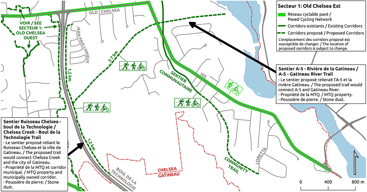
This project will allow for the construction of a dedicated, multi-purpose pathway to provide an active transportation link between Chelsea’s centre village and Boulevard de la Technologie in Gatineau located a few kilometers south. The pathway, which will run along the right-of-way of Highway 5, will offer Chelsea residents new options for utilitarian and recreational use including a safe cycling connection to Gatineau and Ottawa. This modal shift could reduce greenhouse gas (GHG) emissions by a few thousand tonnes of carbon dioxide (CO2). In addition, approximately one hundred thousand dollars in expenses could be avoided by the citizens of Chelsea.
The portion of the pathway along the Chelsea Creek housing project is already built. Soon the firm Multivesco, the project promoter, will complete the connections of the neighbourhood pathways to the Chelsea Creek Pathway.
The main challenge will be the construction of a bridge across Chelsea Creek ravine. Thanks to a grant from the Federation of Canadian Municipalities’ Green Fund, Sentiers Chelsea Trails (SCT) and the municipality are currently working on feasibility studies that will hopefully be completed before February 1, 2021. The current schedule calls for completion of the second phase of studies, plans and specifications in 2021 and trail construction in 2022.
SCT would like to thank the developers of Chelsea Creek and Quartier Meredith for their financial support of this project.
Centre Village Trail Network
Hautes-Plaines Trail Upgrade
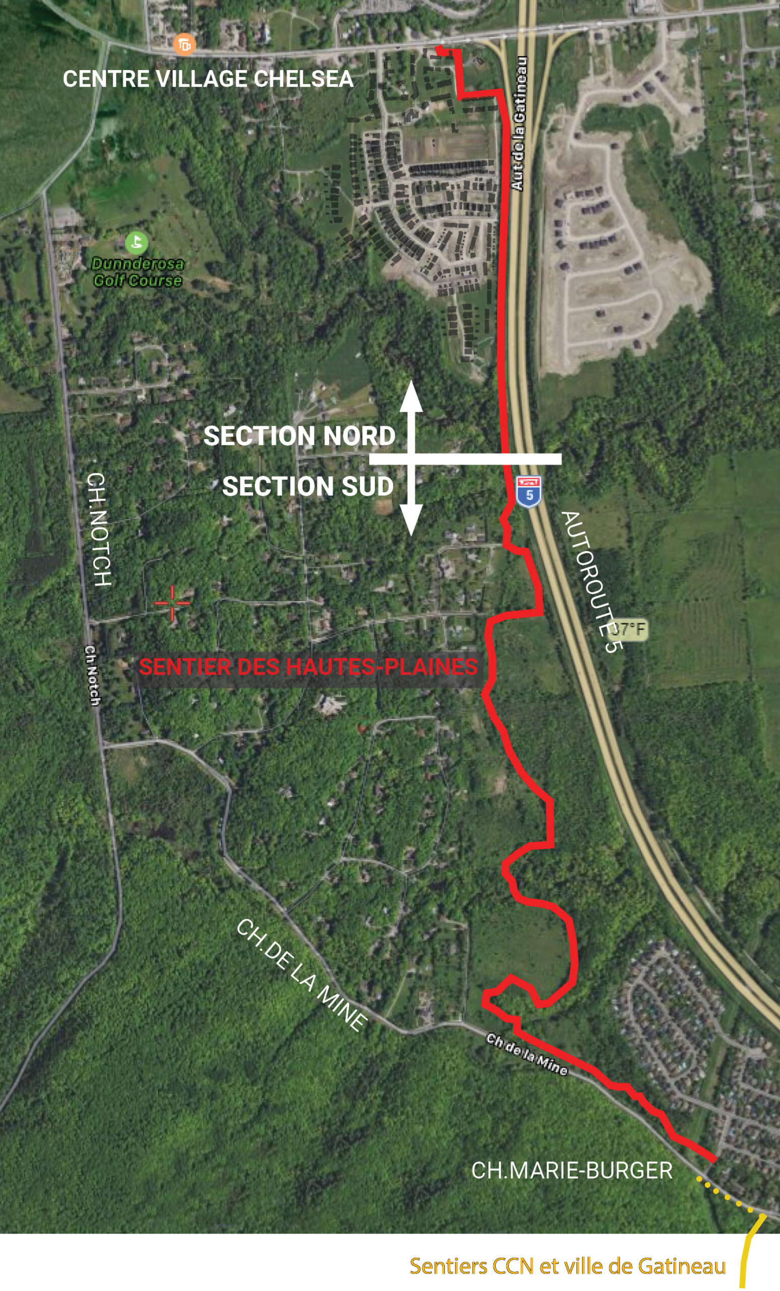
A new project is underway on the west side of Highway 5 to upgrade the Hautes-Plaines trail, connecting Chelsea’s centre-village to Gatineau city limits and the NCC trail network of Gatineau Park. Parts of this 3.8 km trail are well used but other parts, crossing difficult terrain, are in need of significant improvements to the surface and to the crossings over two ravines as well as over Chelsea Creek. Designated as a Structural Corridor (AS2) in the Active Transport Master Plan, this trail, when completed, will offer year-round recreational and active transport commuting opportunities for Chelsea residents and visitors alike.
For planning purposes, the trail is divided into North and South sections.
The undeveloped northern section runs along municipal land acquired for the trail during the Hendrick Farm subdivision process. It extends from Old Chelsea Road to Chelsea creek where it meets the southern section, which is made up of traditional trails on old farm roads and fields now belonging to Quebec’s Ministry of Transport. This southern section of the trail is 2.7 km long and ends at Chelsea’s southern border with the city of Gatineau, where it meets the vast National Capital Commission network of trails.
The short term priority for the Hautes-Plaines trail is to improve trail accessibility by building culverts over two ravines in the southern section. This project is being led by a very active local trails committee of residents from the neighbourhoods bordering the Hautes-Plaines trail.
Sponsors


Supporters


